A technology once focused on aerospace applications half a century ago is finding new utility to improve the safety of driving surfaces in Texas thanks to evolving research at the Texas A&M Transportation Institute (TTI). The effort employs LiDAR — or light detection and ranging — which calculates distances by transmitting a laser beam to an object and gauging the time the light takes to return to its source.

Led by TTI Associate Research Engineer Charles Gurganus, this new effort funded by the Texas Department of Transportation (TxDOT) builds upon earlier work originally designed to improve roadway resilience and add to TxDOT’s Asset Management Plan. Gurganus and his team first used LiDAR in 2017 to measure roadside drainage channel dimensions to ensure those ditches served their intended purpose — to draw stormwaters away from the roadway and guard against premature wear and tear on and beneath the driving surface.
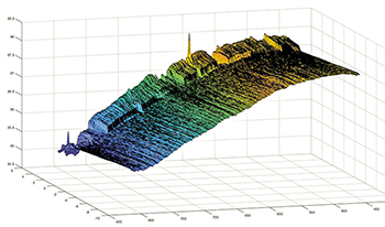
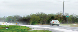
What started out as a method to relate roadside drainage to pavement durability and maintenance needs, however, has now become a way to determine hydroplaning potential. The research team is mapping pavement surfaces to detect spots where thin layers of rainwater collect and fail to drain quickly enough from the pavement surface.
“Water can be an amazing force,” Gurganus says. “And hydroplaning results from a series of events; a lot of bad things happen all at once.”
For example, analyzing data from Texas’s Crash Records and Information System can reveal that a certain 20-mile stretch of roadway has a higher-than-average number of wet-weather crashes, Gurganus notes, but the new LiDAR application can isolate much shorter segments where the pavement geometry might be a contributing factor. And that means maintenance and prevention measures can be more effectively targeted.
This new application of LiDAR is a major advancement, but it brings along with it a hefty challenge, namely processing the sheer volume of data collected for analysis. “It’s the world we live in,” Gurganus points out. “We’re data rich and information poor.”
Overcoming that circumstance is an ongoing task for the research team, which is making the analysis of pavement data more digestible with visualization tools and readily available to TxDOT engineers at the network level.
By applying a technology used by NASA in the 1970s to aid spacecraft development and travel, TxDOT can now make conditions safer for roadway travel.
“TxDOT already does a lot to prevent wet-weather crashes, from warning signs to pavement texturing to aggregate selection,” Gurganus says. “This gives TxDOT another tool to identify and prioritize the most vulnerable spots. It makes it possible to perform surgery with a scalpel instead of a hatchet.”

