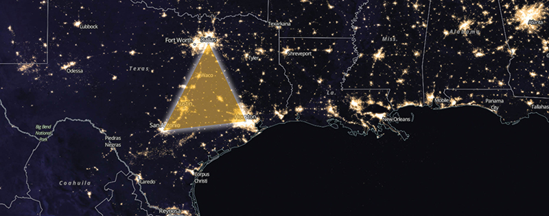
Ever looked at a NASA photo of Texas at night?
The state is a starry spider’s web of lights, with the biggest clusters where you’d expect to find them — across the Texas Triangle of Dallas, Houston and San Antonio. Look at that same view across a few decades, and you’ll see those cities growing toward one another and becoming one big megaregion.
Between those dense population centers are many smaller, rural communities, sparsely populated in some places but wielding significant political power. The influence of rural Texans is evidenced by the network of farm-to-market (FM) and ranch-to-market (RM) roads built to help them sell their agricultural products and livestock. Yet it’s not just farmers and ranchers who benefit from those roads; just ask any driver who’s ever taken a shortcut to get somewhere not easily accessed by interstate or state highway.
The FM and RM road networks solved a problem of geography. Today, we face another geographical challenge: connecting urban and rural areas through a seamless system of intelligent transportation infrastructure. As with the FM/RM roads, all Texans stand to benefit.
You can see it in those NASA photos: the traditional urban/rural divide is breaking down, replaced by megaregions connected by multilane roadways, the Internet and political interests. Showing how advanced transportation technologies can help Texans — especially those outside the beltways — is vital to a coordinated, statewide legislative effort to implement them. In some ways, tomorrow’s rural Texans will rely more heavily on (and can better benefit from) connected transportation than city folks. For example, retirees are leaving big cities to enjoy the quieter country life, and they’re going to need access to doctors, shopping and other services. Advanced technologies and infrastructure can address those needs while improving rural mobility, enhancing safety, and improving quality of life.
But first we must build the state’s intelligent infrastructure. Not simply from the major cities outward, but from both directions — from major urban and smaller rural areas simultaneously. I call the rural effort building “smart dirt roads.” The universities of The Texas A&M System and the Texas A&M Transportation Institute are uniquely qualified to help usher in that future. Besides Texas A&M’s unparalleled expertise in agriculture and engineering and TTI’s worldwide reputation for excellence in transportation research, our home is smack dab in the center of the Texas Triangle. We’re perfectly positioned to work with stakeholders on all sides to get the job done.
In 50 years, Texas can be a model of seamless accessibility, connecting the country home to the grocery store to the doctor’s office. Mobility on demand will be the new utility running in the background of our lives, so ubiquitous it could be taken for granted if we’re not careful. But first, we have to build those smart dirt roads. And to do that, we need to show all Texans how advanced transportation technologies can benefit them — wherever they live.