If you watch police procedurals on television, you’ve probably seen an episode where traffic cameras play a pivotal role in solving the crime. Usually, an analyst zooms in to identify the perpetrator’s license plate, providing the clue needed to close the case.
Using the big-picture power of video imaging can be just as helpful in transportation management. And enhanced by artificial intelligence (AI), today’s imaging technologies can help transportation planners do in a fraction of the time what it took them days or even weeks to accomplish in the past. Researchers in the Texas A&M Transportation Institute’s (TTI’s) El Paso Office have applied advanced video technology to improve transportation at the U.S.-Mexico border for years. For more than 15 years, TTI engineers and analysts have worked with regional stakeholders — including the Texas Department of Transportation (TxDOT) and national and international sponsors — to make cross-border trade and travel safer, more efficient and more secure. In 2006, the Texas Legislature funded TTI’s Center for International Intelligent Transportation Research (CIITR) for just that purpose.
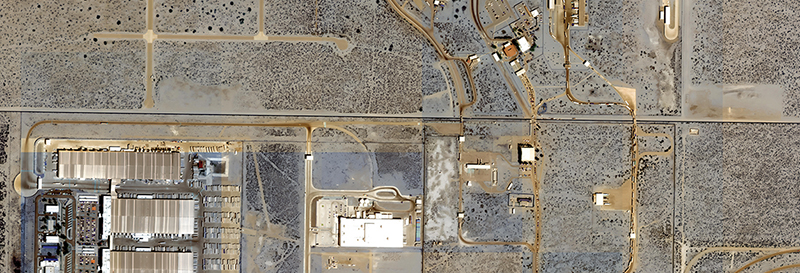
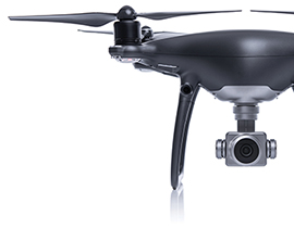
“Leveraging advanced technologies to improve transportation management has always been a primary focus for TTI research at the border,” explains CIITR Director Rafael Aldrete. “Now, we’re learning to extend those traditional applications, like evaluating transportation’s role as a vector in spreading COVID-19 across the border in 2020.” To date, TTI has applied advanced technologies, like high-resolution satellite imaging and drone technology, to enhance border traffic operations. For example, these technologies can help U.S. Customs and Border Protection maintain security while planning for situations when unexpected traffic disruptions at the border cause long lines of trucks.
Using AI is integral to successfully leveraging these technologies since it can analyze thousands of images, enhance their resolution, and extrapolate assumptions about traffic patterns much faster than human beings. TTI helped regional stakeholders apply AI recently to mitigate the effects of supply-chain shortages by determining more accurate wait times at land ports of entry, where delays can negatively impact cross-border commuting and shipping costs.
“We are now in the process of determining how to apply these technologies to facilitate asset management and evacuations during extreme weather events,” says TTI Associate Research Scientist Swapnil Samant. “It’s not inaccurate to say that through these new applications, lives can be saved and injuries avoided.” TxDOT and local partners, such as metropolitan planning organizations, must monitor, maintain and repair the state’s transportation network on a limited budget with finite resources. In TxDOT’s case, that means stewardship for nearly 80,000 miles of roadways statewide, including interstates — more than any other state in the nation. Keeping track of all the damaged bridge rails, pavement and other roadside assets has been a daunting task historically because of the time and effort involved in simply knowing where the problems exist.
“Satellite imaging can make that task much easier,” Aldrete says, “by providing fast, accurate measurements of roadway widths. By sifting through gigabytes of satellite imagery and enhancing their resolution with AI algorithms, it’s relatively easy to inventory where assets are and, as the technology matures, potentially assess their condition and identify needed repairs. That would enable an agency like TxDOT to assess and prioritize repair needs rapidly and efficiently.”
Similarly, these advanced technologies can help agencies not only develop plans that improve their responses to extreme weather events but also create a better plan in advance for dealing with them when they occur. The logistical challenges are enormous for managing mass evacuations before a hurricane hits. But if local agencies know which roads are flood risks, they can plan ahead and direct motorists to safer roadway alternatives. These alternative options can help motorists avoid traffic bottlenecks and even potentially reduce drowning deaths in low areas. Having a response plan in place based on a data-driven understanding of how the network reacts under environmental stressors can also help get first responders and necessary goods, like water and toilet paper, where they need to be faster, safer and more reliably after the event.
“You can even use imagery taken at one location and translate it onto another location, similar to the way deepfakes work,” Samant explains. Deepfakes are a recent trend wherein videos are manipulated or altered from their original form. “So, you could take imagery from one coastal region and determine how the network in another area might function under similar conditions.”
Thirty years ago, helping to solve crimes with high-resolution imaging was more fantasy than reality because camera resolution wasn’t advanced enough — but it got better, and now that reality is here. Similarly, transportation researchers are on the verge of using satellites and AI analysis to show us the bigger picture of transportation with a whole new level of detail.


