Potholes in the road cause more problems than commuters just spilling their coffee. Potholes are also a safety hazard and an expensive burden to the taxpayers footing the bill for repairs.
Thermal segregation, one major cause of potholes, occurs in isolated, low-density areas when the temperature differs greatly during placement of the new overlay. Hot-mix asphalt, the most common surface layer in Texas, requires a uniform application temperature to achieve uniform density and a long life. These “cold spots” are major defects that can cause rapid failure.
“Cold spots look like regular spaced blotches along the road; the surface appears much coarser when you look at it. If you drive over them, you can sometimes feel dips in the road. Over time, water gets in there, and the pavement fails earlier than it should,” explains Tom Scullion, senior research engineer with the Texas Transportation Institute (TTI). “Large differences in surface temperature can severely reduce the life of the pavement.”
Detecting temperature uniformity problems early in any paving job is critical so that corrective action can be taken. Engineers began using handheld temperature guns and infrared cameras to take thermal profiles of new pavement, and this practice is still standard. These methods have limitations since they only provide localized data and require an operator’s constant attention. To eliminate these problems, agencies need other devices that provide 100 percent coverage and real-time feedback.
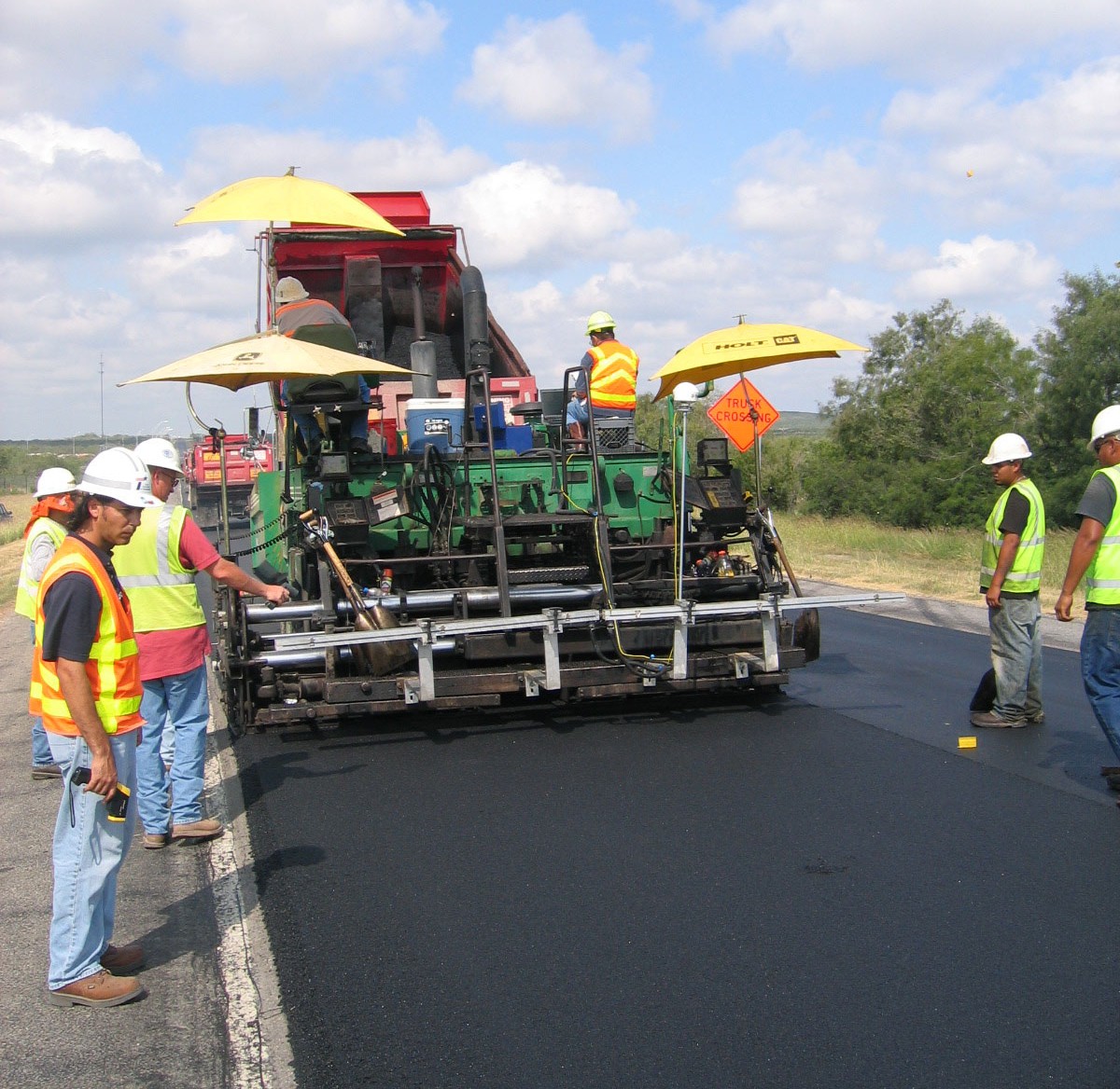
TTI researchers, led by Scullion and Assistant Research Scientist Stephen Sebesta, have developed an infrared temperature bar system called Pave-IR. The Pave-IR uses 10 infrared temperature sensors mounted to the back of the paver and does not need an operator.
Complete with a global positioning system (GPS) and custom software that collects the temperature data, Pave-IR provides a full-coverage thermal profile with real-time feedback. The contractor and agency get quantitative surface data in a color-coded chart of the hot-mix temperatures. The chart, which includes the GPS coordinates of all the very cold spots, provides a map of potential premature failures and assists the paving crew to determine where immediate corrections are needed.
By helping ensure the quality of new construction, Pave-IR allows TxDOT to save taxpayer dollars, improve safety and minimize commuter inconvenience due to closed roadways. “Agencies, contractors and the public all benefit if we construct better quality, longer-lasting pavements. Pave-IR is a tool that will help reach that goal,” confirms Sebesta.
Currently, TxDOT requires a thermal profile of new overlays using a handheld temperature gun. Sebesta and the team are working with TxDOT to update test specifications and regulations to include Pave-IR with the thermal profile requirement.
“The asphalt layer is the most expensive and most visible layer to the public. Drivers judge a road by the way it looks and the smoothness of the ride,” says Richard Izzo, transportation engineer with the Flexible Pavements section in TxDOT’s Construction Division. “Research like this may help us minimize maintenance in the future and produce longer road life.”

