Most of us know the time of day by glancing at our watches or cell phones. But another way to tell time is to watch nature itself. For example, you know winter is just around the corner when you see birds flying south.
Would it surprise you to learn that rivers migrate too? While that process unfolds much more slowly than birds making their way to summer homes, it happens all the same.
Rivers carve out their own courses by eroding their banks and, following heavy rains, sometimes overrunning them. Over time these phenomena change a river’s path. Nature is flexible enough that such changes really don’t impact it much — nature adjusts. But when river migration threatens nearby man-made structures, it’s a different story.
“Highway bridges and other near-bank structures can be severely undermined when a river changes its course,” explains Texas Transportation Institute (TTI) Research Engineer Hamn-Ching Chen. “Having a way to accurately predict a river’s path would be a great help in planning how to troubleshoot such problems.”
Chen and his team developed a method for estimating river migration distances and forecasting the future location of rivers. They examined the erosion patterns of four rivers in Texas — the Brazos, Nueces, Trinity and Guadalupe — to better understand factors influencing river migration.
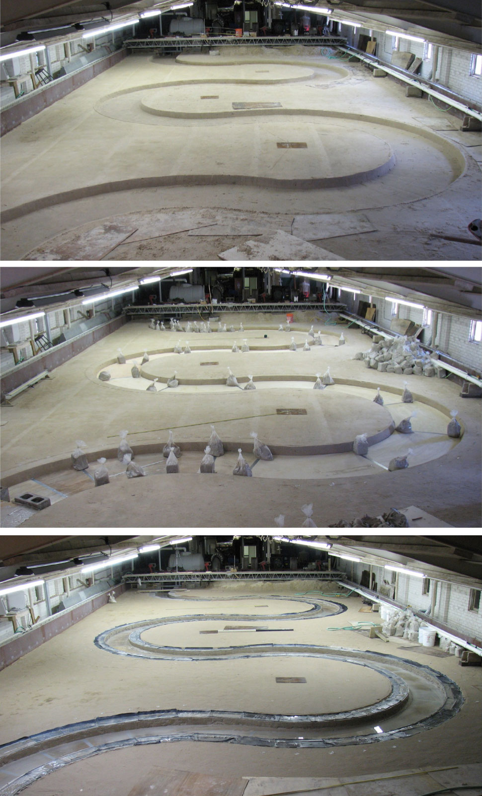
Researchers created a three-dimensional simulation to depict water-flow velocity and shear stress within a curved channel. They then put their modeling to the test using a large-scale flume to examine erosion effects of two different soils (sand and clay) to represent a river’s natural process.
Different channel geometry and flow conditions were examined in what might be the largest-scale flume tests performed to date. The team conducted 18 tests in sand and 8 tests in clay. Since the factors affecting migration are numerous (and nature itself is notoriously unpredictable), researchers used risk analyses to determine possible future river paths. The team developed a computer program, MEANDER, which bases its output on water, soil and geometry input, to automate the prediction process.
“While perfect predictability isn’t possible, the program produces a risk map based on the data entered,” explains Chen. “This map shows the river’s current course and possible future courses, each of which is assigned a probability value.”
While not conclusive, the results can give agencies like the Texas Department of Transportation (TxDOT) a clue as to what structures might be endangered by Mother Nature. TxDOT can then use this data to better plan maintenance activities strategically, thereby improving service and ensuring safety for Texans that use those structures.
“This program gives us a new tool to use in planning ahead,” explains Tom Dahl, design resource coordinator for TxDOT’s North Region Support Center. “And better planning means we can analyze and manage the risks of river migration in both design and maintenance of our transportation systems, rather than simply reacting to migration problems after the fact.”