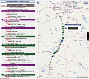
It’s being called the most advanced traveler-information map in the nation. And it was made possible thanks to feedback from motorists who travel Interstate 35 (I-35) in the Texas Department of Transportation’s (TxDOT’s) Waco District. The new map went live Feb. 17, 2014, and vastly improves the information drivers can access before traveling the corridor. It’s part of a larger effort in which the Texas A&M Transportation Institute (TTI) is supporting TxDOT as it expands a 96-mile stretch of I-35 in Central Texas.

“Users can tailor the map to fit their needs and plan for future trips,” explains TTI Research Scientist Bob Brydia, principal investigator on the traveler-information project. “The map is responsive and presents information in the best format for the screen size of the device accessing it.”
I-35 travelers played a significant role in creating the new map. More than 900 people answered questions about the information they’d like to see in the map.
The top suggestions for additions were:
- expected delays between major points along I-35,
- current travel times between major points along I-35,
- current locations of incidents,
- locations and times for freeway lane closures,
- projected travel times between major points,
- detour routes/maps and
- current speeds on each segment of I-35.
“We were able to build the new map with all these improvements,” Brydia says. “It now displays, in real time, the information on each of the dynamic travel-time message signs in the Waco District. You can also customize the map based on direction of travel or how much information you want displayed, including traffic incidents, closures or travel times between locations.” Also, he says, the speeds motorists are currently traveling in each section of I-35 automatically display with different colors, allowing the user to quickly identify any areas of slowed traffic.

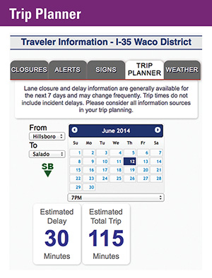
The new map organizes information into tabs: closures, alerts, signs, trip planner and weather. (Smartphone users will also have a map tab as part of the design being responsive to their devices.) Brydia is planning more enhancements based on the survey. In the future, users will be able to view current snapshots from the cameras, which are being installed along the corridor.
“I suggest getting on the site and spending a few minutes becoming familiar with all the enhancements,” Brydia says. “Once you see all the information that’s available, I think the site will become a valuable tool each time you need to travel the interstate.”
Visits to the map continue to grow each month. Even before the enhancements, more than 12,000 visits were made to the map in January.
“Keeping motorists moving and safe is our primary concern during the reconstruction of I-35 through the Waco District,” explains District Engineer Bobby Littlefield. “Providing consistent and complete information about lane closures and emergency situations is a key element to making that happen. On behalf of TxDOT, I want to thank Bob Brydia and the staff at TTI for not only developing but continuing to enhance the valuable tools that are delivering outstanding benefits to the traveling public, all of which have been designed from the responses and requests received from previous surveys.”


