In August and September 2005, Hurricanes Katrina and Rita created many disturbing realities for Gulf Coast states, including the need for safely evacuating large numbers of coastal residents. Five years later, planning and implementation of improved hurricane evacuation information systems using Bluetooth® technology are emerging in Texas.
After these storms highlighted areas for improvement in evacuation plans and procedures, researchers at the Texas Transportation Institute (TTI) began working with Texas Department of Transportation (TxDOT) personnel on improving all transportation aspects of the evacuation process. TTI researchers Michael Vickich and Darryl Puckett have developed a Bluetooth travel-time monitoring system for supporting evacuation monitoring. By providing important data about traffic flow on evacuation routes in rural areas, the system will enable transportation officials to make better decisions during evacuation scenarios.
“Prior to this system, decision makers were put in a very difficult situation when having to choose whether to deploy contraflow or not during evacuations,” explains Tony Voigt, a TTI research engineer. “The new system will give state officials very good information about real-time traffic conditions in the rural areas on evacuation routes, including at what rate traffic is flowing, which will enable them to make more informed choices than in the past.”
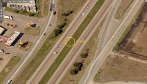
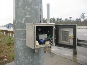
Currently this system is being implemented along I-45 from Houston to Dallas, Texas. This stretch of highway is over 225 miles long and will have Bluetooth device readers placed between 5- and 20-mile intervals, but typically between five and 8 miles apart. This system will work by reading the unique identifier (called a media access control [MAC] address) that each Bluetooth device transmits within a short range as it passes by the antennas.
As vehicles equipped with enabled Bluetooth devices pass by successive device readers, the system matches the MAC addresses and then determines average travel time and speed between the points on the roadway. In an evacuation scenario, this technology will be instrumental in providing an accurate representation of what travel times and average speeds are in rural areas along the highway. With this information, decision makers can make informed decisions, such as whether or not to deploy contraflow or how to respond to incidents.
“The information this system provides for rural areas during evacuation scenarios is tremendous, but its capabilities do not end there,” says Darrell Borchardt, senior research engineer with TTI. “Travel-time information will be available 365 days a year on roadways equipped with the system, which will provide motorists current information about how incidents or other weather-related conditions are impacting travel times.”

Other important benefits of this technology include a low-cost, low-maintenance way to anonymously collect travel time and speed data. MAC addresses do not contain any personal information and are not directly associated with a specific user.
“TTI‘s expertise helped us prove that Bluetooth technology can efficiently and accurately provide segment speeds and travel time data,” says David Fink, TxDOT transportation operations engineer with Houston TranStar. “The traffic information we can now gather in rural areas will better prepare us for countless scenarios — just one of which is hurricane evacuations.”
